Why the Baraboo Region Matters
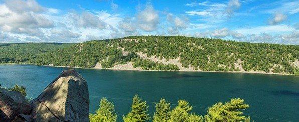
The Baraboo region of south-central Wisconsin offers an unusual opportunity to observe multiple chapters of Earth history preserved within the same landscape. Ancient marine environments, metamorphosed Precambrian rocks, glacial modification, erosion, and modern landscape evolution can all be observed within a relatively small geographic area.
Field observations at Elephant Rock, Tunnel City, and Parfrey’s Glen reveal more than isolated rock formations. Together, these locations preserve evidence of environmental change through time, from high-energy Proterozoic sand deposition and Cambrian shallow marine environments to glacial reshaping and ongoing erosional processes.
Rather than simply identifying rock types, the Baraboo region provides an opportunity to interpret how depositional environments shift, how landscapes evolve, and how geological processes continue shaping the region today.
Reading the Great Unconformity at Elephant Rock
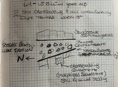
Elephant Rock, located along the East Bluff of Devil’s Lake State Park, exposes one of the most dramatic geological relationships in the region: Cambrian sandstone resting directly atop the Baraboo Quartzite across a major unconformity.
The Baraboo Quartzite began as sandstone deposited in a high-energy environment during the Proterozoic before later undergoing metamorphism. Despite this transformation, cross-bedding remains preserved within the quartzite, providing evidence of its sedimentary origin. Above it lies Cambrian sandstone deposited hundreds of millions of years later.
Between these units is a remarkable gap in geological time, a period representing nearly one billion years of missing rock record commonly associated with the regional expression of the Great Unconformity.
At the contact between these layers, a conglomeratic unit records erosion of the underlying quartzite prior to renewed deposition. The contrast between the resistant quartzite cliffs and younger sedimentary rocks helps explain much of the dramatic topography surrounding Devil’s Lake.
The surrounding landscape also preserves evidence of much younger processes. Freeze-thaw weathering during and after the last glacial period contributed to the development of extensive talus slopes visible beneath the quartzite cliffs, demonstrating how ancient bedrock continues to shape modern landscapes.
Tunnel City and an Ancient Marine Environment
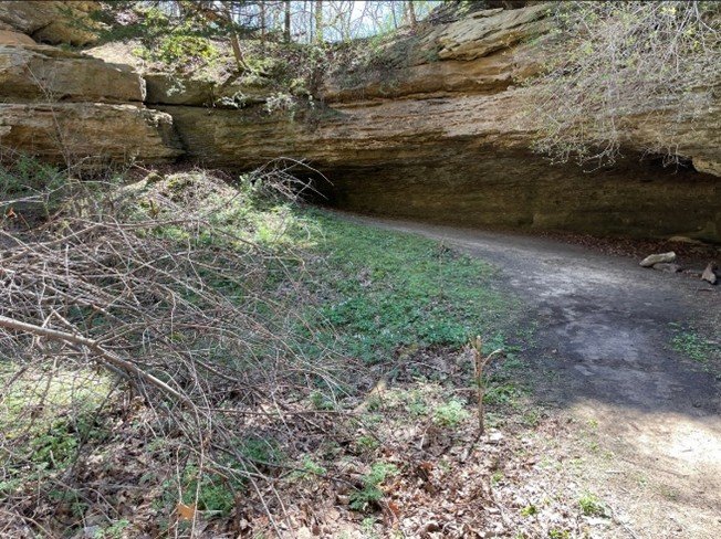
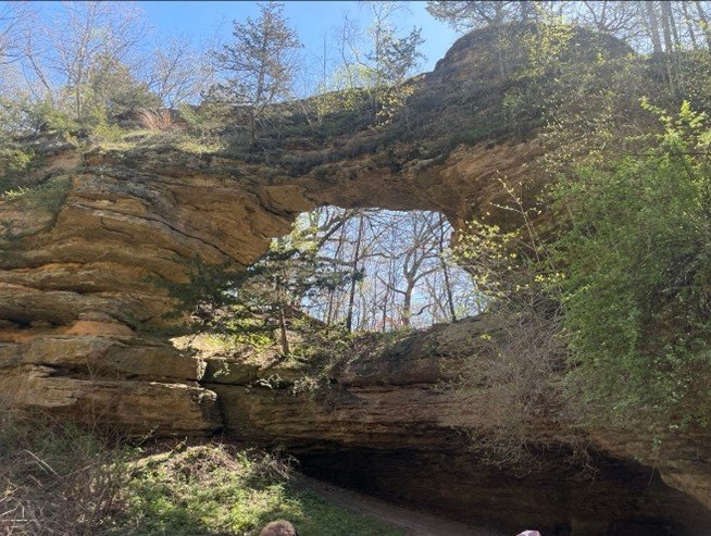
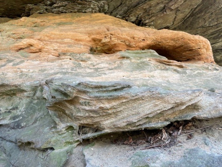
The Tunnel City land bridge provides evidence of shifting depositional environments within a Cambrian shallow marine system.
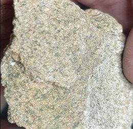
At this location, two sandstone units reveal changing environmental conditions through differences in color, sedimentary structures, and depositional characteristics. The lower Lone Rock Member contains olive-gray sandstone rich in glauconite along with cross-bedding and herringbone cross-bedding — sedimentary structures commonly associated with tidal influence and changing current directions.
These features suggest deposition within a shallow marine environment influenced by fluctuating tidal conditions and varying energy levels.
Overlying the Lone Rock Member is the tan-colored Mazomanie Member, which preserves cross-bedding but lacks the tidal herringbone structures observed below. The change suggests more consistent flow conditions and shifting depositional energy within the same broader marine setting.
Together, these units preserve evidence of facies transitions, where environments changed laterally and through time as sediment accumulated across a dynamic shallow marine system.
The land bridge itself reflects a much younger story. Differential weathering and erosion exploited weaker zones within the sandstone, gradually carving openings and undercut features that produced the natural arch-like structure visible today.
Parfrey’s Glen: Reading Facies Change Through the Landscape
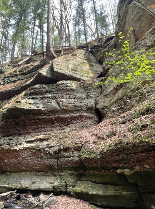
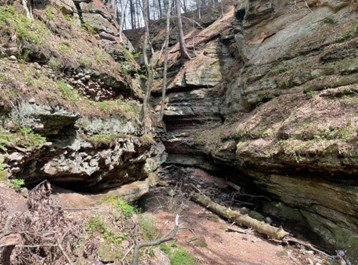
Parfrey’s Glen provides another perspective on Cambrian deposition while also demonstrating how modern erosional processes continue modifying ancient rock.
The gorge exposes sandstone interbedded with conglomeratic deposits containing pebbles, cobbles, and larger clasts. These alternating layers record fluctuating depositional energy within a shallow marine system, where calmer conditions allowed finer sediment to accumulate while higher-energy events transported larger material.
Rather than representing a completely separate system, these deposits preserve another facies within the same Cambrian environment observed at Tunnel City. Different sediment types formed simultaneously in different depositional settings, reflecting shifting environmental conditions across the landscape.
Modern erosion continues to shape the gorge. Streams exploit bedding planes and zones of weakness while seasonal freezing, rainfall, and runoff progressively widen fractures and steepen valley walls.
Parfrey’s Glen serves as a reminder that geology records both ancient and active processes at once — preserving evidence of environments hundreds of millions of years old while simultaneously being reshaped in the present.
Reconstructing an Ancient Landscape
Together, the Baraboo geology exposures record a landscape shaped by:
- Proterozoic high-energy sand deposition and later metamorphism
- Long periods of uplift, erosion, and missing geological time represented by the Great Unconformity
- Cambrian shallow marine deposition and shifting tidal environments
- Facies transitions across changing depositional settings
- Pleistocene glacial modification and altered drainage patterns
- Ongoing erosion through weathering, stream incision, and seasonal freeze-thaw processes
Viewed together, these sites illustrate how landscapes preserve evidence of multiple geological systems interacting through immense spans of time.
Final Thoughts
The Baraboo region reinforces an important lesson in geology: landscapes are stories of process, change, and interaction.
Rock formations do not exist in isolation. Sedimentary structures, erosion, depositional environments, glacial modification, and modern weathering all contribute to understanding how a landscape formed and continues to evolve.
Standing within these exposures shifts geology from memorizing formations to interpreting environments and reading the evidence preserved in rock and reconstructing the environmental history that shaped the modern landscape.
What to see more content like this?