Current Research
Landscape Change • GIS • Environmental History • Geomorphology
Featured Research
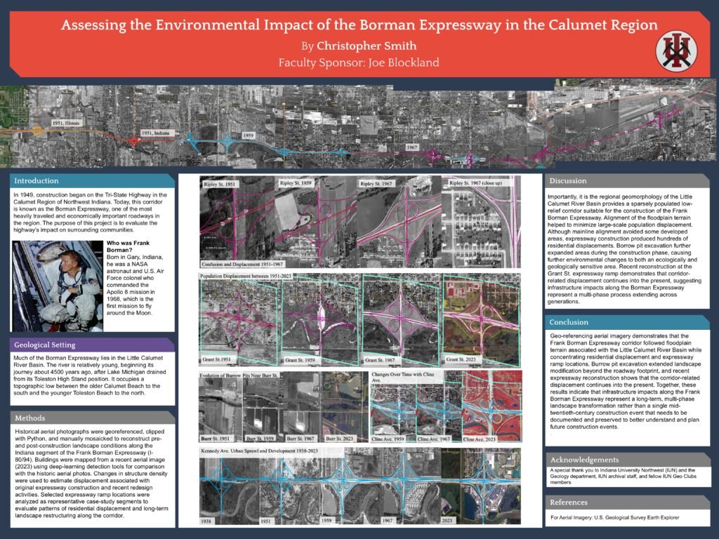
Assessing the Environmental Impact of the Frank Borman Expressway in the Calumet Region
The Frank Borman Expressway is one of the nation’s most important expressway routes, with over 200,000 traveling on it daily. This research uses historical aerial analysis to examine environmental and landscape change along the Borman Expressway corridor in the Calumet Region of Northwest Indiana. Using georeferenced historical imagery, ArcGIS Pro, and spatial analysis methods, the project reconstructs the timing and progression of highway development from the late 1940s through the modern era.
Historical imagery reveals significant differences in how sections of the corridor affected surrounding landscapes and communities. While some areas experienced minimal disturbance, later construction and interchange development resulted in greater landscape disruption and residential displacement. This work combines GIS analysis, historical interpretation, and geospatial methods to understand long-term environmental and community impacts associated with transportation infrastructure.
Methods & Tools
Research Methods
Historical Aerial Georeferencing
Reconstructed landscape change across the I-80/94 corridor using historical aerial imagery from 1938–2023 to identify environmental and community transformation over time.
GIS Feature Extraction
Mapped roadway expansion, interchange modification, displaced neighborhoods, and evolving land-use patterns associated with transportation infrastructure growth.
Python & AI-Assisted Analysis
Applied computational tools to compare historical imagery datasets, identify spatial change patterns, and support quantitative landscape interpretation.
Historical Landscape Interpretation
Integrated geomorphology, environmental history, and urban development patterns to interpret long-term impacts on the Calumet Region landscape.
Explore more on the Frank Borman Expressway