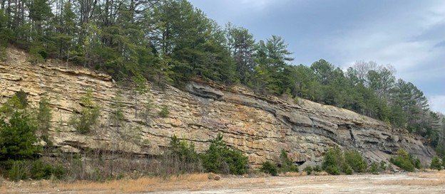
Most people standing in front of a rock exposure see layers of stone. A geologist sees something very different: evidence of environments that existed hundreds of millions of years ago.
During field observations of Cagles Mill geology at the emergency spillway in Indiana, I examined exposures of the Lower Pennsylvanian Mansfield Formation to understand better how sedimentary structures, lithology, fossils, and stratigraphic relationships can be used to reconstruct ancient depositional environments. What emerged was a fascinating story of a migrating meandering river system preserved in the rock record.
Why Cagles Mill Geology Matters
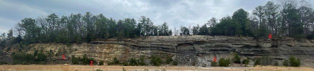
The spillway exposure at Cagles Mill provides an unusually continuous view of Pennsylvanian-age sedimentation and preserves evidence of several connected depositional environments within a single landscape.
Rather than representing one static environment, the exposed strata record changing conditions across an active floodplain system shaped by river migration, flooding, wetland formation, and abandoned river channels. Evidence preserved in the outcrop includes floodplain mud deposition, sandstone channel deposits, coal-forming wetlands, abandoned-channel lakes, and crevasse-splay flooding events.
Reading the Floodplain
One of the lower units in the exposure consists of laminated shale dominated by silt and clay-sized material. Fine-grained sediment like this generally accumulates under relatively quiet, low-energy conditions.
In this case, the deposit likely represents overbank flooding across a floodplain surface. During flood events, suspended sediment settles out beyond the active river channel, gradually building muddy floodplain deposits. The lack of energetic sedimentary structures such as cross-bedding suggests deposition occurred away from the main flow under calm-water conditions.
Evidence of an Active River Channel
Above the floodplain deposits, the story changes.
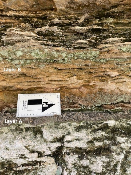
Ripple-laminated sandstone and trough cross-bedding indicate a much more energetic depositional environment. These sedimentary structures form when flowing water transports and reorganizes sediment within an active river system.
At Cagles Mill, asymmetrical ripple structures indicate southeast-directed paleoflow, while sandstone geometry and internal bedding support interpretation of deposition within a migrating point-bar environment associated with a meandering river channel. Mica concentrated along ripple laminae also suggests changing flow conditions as energy waned during sediment transport.
When Rivers Change Course
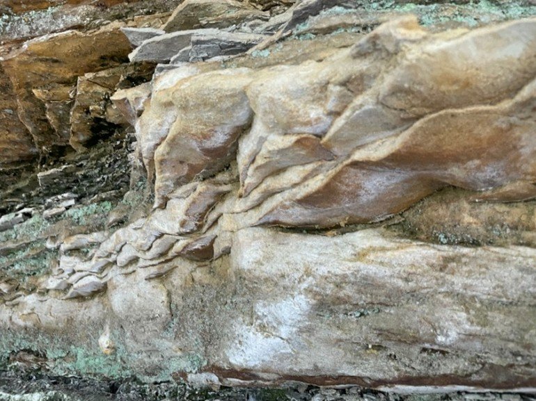
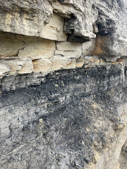
One of the most interesting transitions preserved in the section occurs where sandstone deposits are overlain by coal-bearing material.
This shift records a dramatic environmental change.
Rather than continuing as an active channel, the river migrated and abandoned part of the system. Following cutoff of a meander bend, stagnant, waterlogged conditions allowed peat to accumulate in an abandoned-channel depression or oxbow setting. Over long periods of burial and compaction, peat becomes coal. Thin sulfur-rich laminae within the deposit further suggest reducing conditions consistent with swampy environments.
From Swamp to Quiet Lake
The story does not stop at peat accumulation.
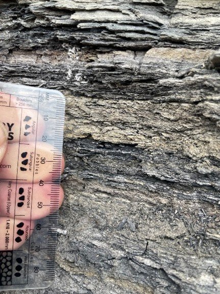
Thinly interbedded shale and siltstone overlying the coal deposits suggest continued low-energy sedimentation within an abandoned-channel lake. Fine sediment gradually settled from suspension as the oxbow depression slowly filled.
Together, these deposits preserve an environmental transition from active river channel → abandoned channel → swamp → quiet-water lake infilling. In many ways, the rocks function like an environmental archive preserving landscape change through time.
Flooding Across the Floodplain
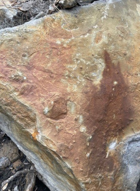
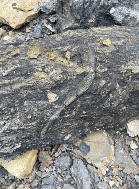
Elsewhere in the section, evidence points toward crevasse-splay deposition — sediment deposited when floodwaters breach natural levees and spill onto adjacent floodplains.
Ripple structures, sandstone deposition across a paleosol surface, and fossil-bearing material suggest short-lived but energetic flooding events that temporarily reshaped the landscape and were later recolonized by organisms. These deposits provide another reminder that ancient floodplains were dynamic systems constantly responding to river movement and changing hydrologic conditions.
Reconstructing an Ancient Landscape
Together, the Cagles Mill geology exposure records a dynamic Pennsylvanian floodplain shaped by:
- River migration
- Floodplain mud deposition
- Point-bar sedimentation
- Oxbow abandonment
- Peat-forming wetlands
- Quiet-water lake infilling
- Crevasse-splay flooding events
Rather than isolated rock layers, the exposure preserves a connected environmental story of how rivers repeatedly reorganized landscapes across Pennsylvanian Indiana.
Final Thoughts
One of the things I enjoy most about sedimentary geology is that exposures like this allow us to reconstruct environments that no longer exist. With enough field observations, bedding geometry, sedimentary structures, and stratigraphic relationships begin telling a story.
At Cagles Mill, those clues point toward a migrating meandering river system that repeatedly reshaped a vegetated Pennsylvanian floodplain hundreds of millions of years ago.
Interested in my geology research and field work? Explore my Current Research page to learn more about ongoing GIS, landscape change, and environmental geology projects.