Abstract
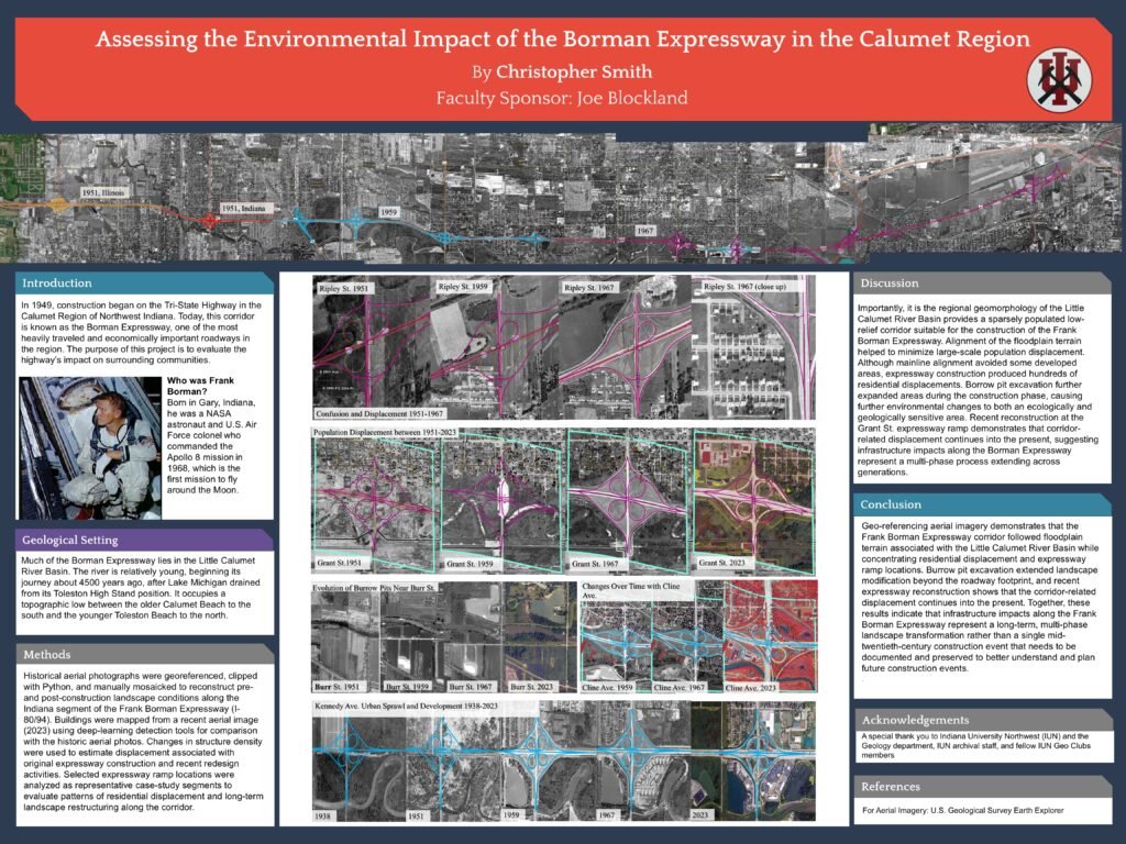
This research examines how construction of the Frank Borman Expressway transformed landscapes and communities throughout the Calumet Region of Northwest Indiana. Using georeferenced historical aerial imagery, GIS analysis, and landscape interpretation, the project reconstructs patterns of roadway expansion, interchange modification, and community displacement from the late 1940s through the modern era.
Research Themes
* Environmental change
* Floodplain modification
* Residential displacement
* Geomorphic interpretation
* Historical reconstruction
Organizations Involved
* Indiana University Northwest
Conference Presentation
This research was presented at the Indiana University Northwest Student Research Conference. The official conference listing for Christopher D. Smith’s Historical Analysis of the I-80/94 Frank Borman Expressway is available through Indiana University Northwest.